Previous page
Back to the 2007 index page
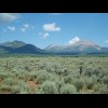
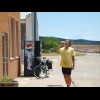
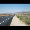
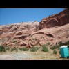
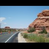
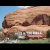
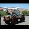
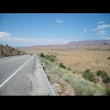
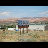
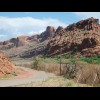
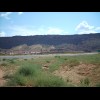
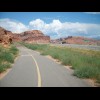
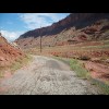
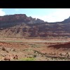
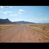
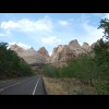
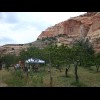
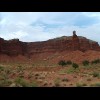
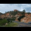
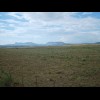
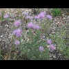
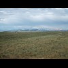
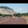
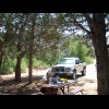
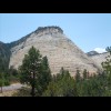
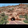
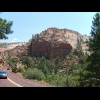
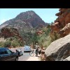
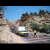
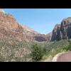
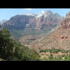
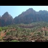
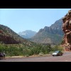

Utah


On the right is Mount Peale. Some maps show La Sal as the largest settlement along this road while others don't metion it at all ... A few hundred metres behind me is a marix board flashing a warning that I should 'expect delays' on ... Red rocks. I thought the chemical toilet would give an idea of scale. The lane on the right is coned off but in perfect condition so that's where I'm riding, not that the... 'Hole n The Rock'. I'm not quite sure about the punctuation on the big sign. It's a 14 room house ca... Pictures of this appear in a lot of the publicity for Hole n The Rock. It's a jeep made out of numbe... Some memorabilia, and some bikes. This valley is a lighter colour than the surrounding rock. It's called Spanish Valley. It's where Mo... I've booked a Rodeway Inn for tomorrow night. I thought it would be worth seeing where this one was ... The patches didn't really last but somehow the wheel brought me here all the way from Colorado. The view from my hotel window. As soon as I got in, I called the bike shop to see if they happened t... The first restaurant I found when I headed into town from my hotel was this one which has its own br... Moab scenery. I left last night's hotel about as late as I could and am now wandering into town to s... Moab is a big centre for outdoor activities, mainly rafting, off-road driving and mountain biking on... Moab again, of course. I like the architecture; it all feels rather wild west. There are a lot of pl... This is the wild west. Look where I got my money from! Here's the bike shop. They told me they normally receive deliveries at noon so I'll go and mooch aro... To kill some time, I visited this Italian restaurant. I thought I could have a leisurely lunch at on... This thing's tyres are in worse condition than mine! The UPS delivery hadn't turned up when I checke... Here's the UPS man heading towards the bike shop. I wonder if he's got my wheel. The left part of this building is a restaurant while the right part is an estate agent's office. Wha... There are lots of oversize loads on the roads but this has to be the longest I've seen yet. Another ... It's getting to the point now where it will be too late to ride to Green River today so I've got a h... Another Moab view. Another outdoor company with more canoe-towing buses. The UPS van did arrive at the bike shop in the end but my wheel wasn't on it. It will be at least to... Moab in the evening. I think I overestimated how hungry I was tonight. I could barely finish my star... They definitely expect bikes in this town. While I was sipping a smoothie at a pavement cafe and waiting for the Chinese bufet to open, somebod... The Colorado River. Not a great view of it, I'm afraid. My wheel arrived and was fitted quickly so n... The flat pile of earth behind the buildings is the spoil tip from an old uranium mill. The authoriti... I was riding along the road and spotted this cycle lane to my right. I don't know how anybody is exp... The entrance to Arches National Park, as it says. After a while, I began to wish I had never seen the cycle path. It started off as good smooth tarmac... I wish I was still on that road! This has got beter now. The map says there's nowhere to get water along this road. It doesn't seem to know about this bar. P... It looks like a giant Vienetta! Scenery. The map shows that by going 9 miles along that road and crossing several junctions with other simila... Here goes then. This is the freeway entrance. This road is an absolute dream. I was only intending to stay on it for 7 miles but now I'm going to ... The interstate skirts around an area of these lumpy things so I have them on my right and fairly fla... There's a cloud. I still don't believe it's going to rain though. This sign lists some of the hotels in Green River, although not the one where I will be staying. The... Better get off here then. Here comes another of those long trains. I'm back on the interstate again for an hour or so. Look at this view. The interstate disappears off down that canyon. I'm going a different way though. On Google Earth, this road is visible from an altitude of about 90 km as a black line cutting across... This sign pointed down a dirt track. I certainly wouldn't do 100 miles on a track like that. Haribo! Sweets are continuing to get better. You can get these all over Utah. A signpost identified this as a 'scenic view'. It's not wrong. At Hanksville, where I rejoin the Western Express route, the petrol station shop is another of those... Dustbin art at what looked like a disused motel. I've never seen a river that colour before. I'm not sure I would want to swim in water which loked like that. Look at the colour of the waterfal... This is the Capttol Reef National Park. It's called 'reef' beacuse it forms a barrier to travel, and... I didn't expect a pick-your-own peach site in the middle of this rocky area. I didn't stop though as... I think that feature is known as Chimney Rock. The view from my window in Torrey. Presumably this is the town whose canyon gave its name to the tan... There's a bit of a sheep theme in this hotel. I don't know if sheep are farmed round here. I don't r... I'm back in the mountains and it's raining again. I should have learned by now that American rain ne... This was a scenic overlook a few minutes ago, then all these vehicles turned up. Why would you want ... I'm glad the cloud has lifted or I wouldn't be able to see this. The big peaks in the distance are M... About a third of the way across this picture, behind the long stripey ridge, are the fins of rock wh... I've stopped at an information centre. I rather wish I hadn't as the only information I gained up wa... Here is some more scenery. I've just passed today's summit at 9600 feet. I don't think I'll have to ... More of the view from the same place. Here's my room at the Boulder Mountain Lodge. It's quite smart and probably is worth the extra money... The main building of the Boulder Mountain Lodge. It's not your typical motel. Its aim is to 'help th... Here's one of the Lodge's communal areas, not getting much use at the moment. The 11 acre wildfowl sanctuary. Here's the restaurant. Sitting on the restaurant terrace, I had this rather pleasant view of a pond with a healthy populati... Here's my starter. A lot of the food served in the restaurant is grown in the lodge's own garden or ... Near the entrance to the lodge. I think these prayer flags are a contimuation of the Buddhist theme.... I'm now standing on something called the Hog's Back, which is indeed a very scenic road. Another view from the same place. Canyons. Here, the road zig-zags along the ridge, with steep drops off to either side. I saw a tourist coach ... I'll be going down there in a few minutes. There's my bike! You can see where the cutting for the road has been blasted out of the rock. I've j... Looking back down to the Escalante River from a place called Boyton Overlook, part way up the first ... The start of the road down to Escalante. The second climb was one of those good ones: very gradual and through pleasant scenery like this. I ... I like these high pastures. Oh, what happened to the greenery? Or 7400 according to the cycling map, or about 7800 according to the elevation profile on the other ... I've finally leared to find some shelter when the rain starts and wait for it to stop. I can't imagi... It had probably finished raining by the time I had finished my burger but I stayed for a cake anyway... A view of Tropic, Utah. I only really took this because it has just ocurred to me that I hadn't been... More of these letters on hillsides. You might have noticed a 'T' in the previous photograph. I don't... More of Tropic. Back into the rocks for the third climb. Just scenery really. Nothing very interesting, just a thistle. The collection of huts on the left is Bryce Canyon Airport. There's disagreement over whether this summit is higher or lower than the previous one. Here's the Red Canyon cycle path. It was decided that the road here was too dangerous for cyclists s... I've seen photographs of this sign before although to be honest I never really expected to get this ... That's not a natural arch; it's a tunnel for the road. The dry river bed. You can see how the Red Canyon gets its name. This is the last you will see of the Western Express, ... It was lucky that I stopped for an afternoon meal yesterday because my motel's own cafe was shut and... Green Valley. Today's ride is mostly downhill, although there will be one climb in Zion National Par... The little village here is called Mount Carmel. According to another of those roadside monumnets, it... Mount Carmel Junction, where I will leave Highway 89 and head into Zion. I think I might stop for so... Mmmm, propane. My favourite! This is quite a striking hotel and restaurant. I however opted for the more mundane-looking one behi... A few days ago, I read a journal by somebody who took the route which I am taking now, but in the op... Do you think those are the buffalo in question in that field? Heading towards Zion Park. The sign says The entrance to Zion Park, where I was given the crushing news that I wouldn't be allowed through th... Despairing in Zion Park. There is a track which branches off the road here and, according to the Par... Checkerboard Mesa. Because of the lines. They don't mind me riding through this tunnel. It's the next one which has destroyed my holiday. A rock. This is as far as I can go. The tunnel is just ahead. The hat, by the way, bears the name of Moab, w... This is Valerie, from West Virginia, who guards the entrance to the tunnel. I spent a while here whi... I'm now in the back of a pick-up truck, sitting on the wheel arch. It's kind of like being in a car ... In the tunnel. In a few places, there are holes in the cliff face so you can see out from the tunnel. Passengers in the following car taking photographs out of the sunroof. The guard at this end of the tunnel has come a long way. Zion. There's the road, snaking its way down the valley. Zion. Again. Springdale. Springdale. Rocks. I missed the first bike shop but found the second, which had a few parts for sale but no suitable ty... I'm finally out of the high mountains now so there won't be any more of this kind of thing. Ever sin... Springdale. This pole is apparently number 1356 Zion Park Boulevard. In most American towns, the house numbers a... Another view of Springdale in the evening. Inside the restaurant. There's a penny farthing up there, and some other bicycle paraphernalia aroun... Rockville. Population 247. Founded 1892. I've yet to find a town which declares its population, date... I think this road leads to a new housing development. The flags are showing a wind in my favour, whi... Rockville may not have declared an altitude but Virgin gives one to an excessive degree of precision... Another geodesic dome house. This seems to be some kind of tiny recreation of a wild west town. I don't really understand why it ... Looking down towards the next towns, La Verkin and Hurricane. I just thought those little houses looked funny with their roofs matching the slant of the rocks beh... Still going down. There's a paved cycle path to each side of the main carriageway and a sign saying ... Any takers? The road into St. George, the first town since Moab which has been big enough to have all these fast... Found one! There's a palm tree! The first one I've seen. The St. George dinosaur museum is somewhere over that ridge. It's meant to be worth a visit but my p... Here's a roundabout. I can't have seem more than about four during this trip. This one is where I wi... This is probably the only Arizona flag I will see. I'm not even in the state yet. This is at the