Previous page
Back to the 2007 index page
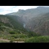
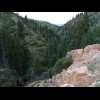
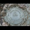
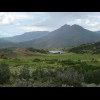
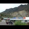
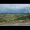
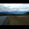
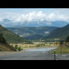
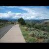

Colorado


This doesn't give me much confidence that the phones will work any better here than in Kansas. The first few towns along this road in Colorado really do seem to be where the streets have no names... Snake! I think it's dead though. I did see one in Pennsylvania but didn't stop to photograph it. The... Towns in Colorado don't give their populations but do give their altitudes. This is Eads, at 1284 m.... It looks like a purple people eater to me! I followed this railway for most of the day and thought there didn't seem to be many trains on it. I... Probably a new oil well or something. What's of interest to me is the way those flags show what a wo... Do you know what this is? I mentioned a few days that it was coming up. Yes, it's the nation's small... For somewhere with a population of 84, Haswell seems well served. There's a petrol station and shop,... Finding a shady place to repair a puncture. The tyre needed topping up a couple of times after this ... Still pretty flat. A little way back, there was a 'for sale' sign just beyond the fence. It looked l... Sugar City. The red and yellow thing is an old railway car. It looks like these silhouettes in the f... Even though Ordway was 140 miles into today's ride, it still seemed much too early when I got there ... That's got to be the poshest cash machine I've ever seen! Here's the motel. Its name is slightly different from that listed on my map but the policewoman loit... I did make it to Pueblo last night, although it was dark when I got here. That means I'm actually ah... When I arrived last night, I went happily shooting down this road following the signs for the city c... This was the view out of my window, except that the bins were full when I arrived. There wasn't any kind of information booklet in the room like you get in most hotels, just this piec... Pueblo, with the Rockies behind. As usual, sorry about there being wires everywhere. That's a lot of coal! This is the bike shop. Would you believe it's open? It's hard to tell whether shops are actually ope... They have yellow fire engines here, and some interesting architecture. It took me a while to find the town centre. I thought that it would be around here but this district... Pueblo is another of those cities which has installed works of art everywhere. This one doesn't look... This shop says it sells medical supplies. A cowboy outfitter's. I've seen quite a few people recently in full cowboy gear. There was one in th... Central Pueblo. A fountain in central Pueblo. More art. The building with the large red roof is enclosing the excavation site of the original Pueb... A replica of the trading post outside the museum. I've left my bags at tonight's motel but can't get... One of Pueblo's less historic buildings. The funny three-wheeler belongs to a traffic wardern. I saw a few of them, or maybe it was the same ... Nice mural. This one's a cyclist. The riverside area, one of Pueblo's main tourist spots, not that there are many tourists around at t... I was on my way to an out-of-town shopping centre where the yellow pages said there was a mobile pho... More of the riverside area. Another part of the riverside. All of the roads in this part of Pueblo have brown signs giving their original Spanish names. A marching band assembling in the park. This is Pueblo's park. There's a zoo in here somewhere but I didn't see any animals apart from ducks... Here come the hills. Today is the day I enter the Rockies. It will be a day of about 105 miles but I... Mountains. The view to my right. I could be wrong but I think the tallest mountain visible here, about two thir... The view to my left. These are the Sangre de Cristo mountains. It's getting steep now. I hope it doesn't stay like this all the way to the summit of today's ride, ... This view is very familiar. I've been here in Google Earth a few times. In some ways, it's hard to c... Wetmore. Change here for the Hoosier Pass and all points to Oregon. This is where the Western Expres... A shop situated where the proper climbing begins, just outside Wetmore. Since I was going into the m... A view of the hills from the shop. I'm having a good rest here before tackling the 3000 foot climb. A hummingbird, hovering while it decides whether to land on the watering device. The scenery of the Hardscrabble Valley. That seems like a good description of this area. It's beautiful up here. That was amazingly easy! I've done the climb and am now at at altitude of just over 9000 feet. I've ... I believe what I've just climbed is known as the Front Ridge. Now I'm going to go down a bit and the... Hello, penguins. Coming down from today's summit towards Silver Cliff, a town at just 2433 metres. Silver Cliff. Silver Cliff. There's a lot of junk here. This taxidermist just caught my eye. It's not the kind of thing I often see advertised. Beckwith Ranch. This was signed as a point of interest but I didn't stop to see what was interesting... It's raining over there. I think that's where I've got to go next. I don't care though; that will ma... I don't think I can aford this ranch. It's raining now. It hurt enough to be hail but I didn't see i... This is Cotopaxi, where I rejoin highway 50, the railway and the Arkansas River, which have come up ... This river is popular with canoeists. It had quite a few rapids. The sign says it all really. Just enjoying the view. And again. This is Salida, pronounced like saliva but with a 'D'. It's main street has all the same hotels, fas... I don't know why that peak has a big 'S' painted on it. All of the hotels in Salida had rave reviews when I looked on-line. One of the reviewers of he Days ... Here come the real biggies. These mountains are called the Collegiate Peaks and are named after famo... Guess what - mountains! You would never guess from this bit of sky that there was thunder rumbling behind me. It turns out t... The first 23 miles of today's route are constantly uphill, resulting in a rise of nearly 4000 feet t... Some sort of quarrying goes on here. There were lorries going in and out. That building looks like i... Just a pretty mountain stream. I've just come up that valley. This climb has almost exactly the same profile as yesterday's but I'm... Here's the visitor centre at the summit, situated at an altitude of 11312 feet or 3448 metres, right... All cyclists who come this way like to pose in front of that monument. What I hadn't realised until ... Here's a picture anyway. I didn't go in the cable car. The first 10 miles from the Pass took just under 20 minutes. Like the ascent, the descent wasn't too... Nothing special. Another random view of the scenery. There's more rain coming. It would catch me before I reached Gun... It's nice of the road not to make me go over those ridges. Even better, it maintains its wide should... When I opened the door of my motel room this morning, this helicopter was flying straight towards me... This is the centre of Gunnison. It seems like quite a touristy town. In fact, it's about the first p... There are lots of bikes here, and provision for even more to be parked. Gunnison again. This is a different bike shop to the one where I went. The people in the shop where I went were very... Nice day for an outing on the lake This is part of the Blue Mesa Reservoir. Impressive scenery. I think the reservoir might be where those trees are in the middle-distance, hid... There are quite a few cyclists on these roads but none seem to have enough luggage to be following t... The Gunnison River. Steep! I thought this was interesting. Again, more scenery. I think this might be a meerkat. There were a few of them standing there but most disappeared down h... As well as the dodgy wheel, I had more gear trouble today. The cable for the rear mechanism snapped ... I stopped here for some sweets. There seems to be a lot of rubbish sold in that shop. Rocks, for ins... The ascent to Cerro summit. It's all downhill from here to Montrose, 15 miles away. My bodge with the cable is working so well t... The yellow thing on the left is a pile of sand on some kind of construction site. In the background ... This is my hotel. It's the smartest Super 8 I've every seen. They are normally pretty basic motels. ... There are some motorcyclists staying here. I like the trailer which looks like a small car. Things are going surprisingly well at the moment. My phone worked when I got here so I called the bi... The road out of Montrose, featuring one of the motorcycle-trailer combinations which are popular aro... This is the first wild cactus I've seen. The Uncompahgre River. A dramatic skyline. Vultures. Is that a worrying sign? The road here looks like it plunges straight into Ridgway Reservoir. This cycle trail leads to Ridgway. I don't know if it's new but the Western Express map doesn't ment... Ridgway, known as 'the town that refused to die'. It's a bit of a tourist trap now. There's the sheriff! Would you eat at somewhere called the True Grit Cafe? This machine seemed to have a mind of its own. It just sat there flashing up random numbers regardle... Taking a break on the way up to the Dallas Divide, a 2734 metre pass. The rocks are a different colour now. This is starting to turn into the kind of scenery that I will ... Spoilsport! The San Miguel Canyon. I've just come up the road on the right. I've now left the Western Express ro... These deer watched me for a while, then took a few paces away and watched me again. Several places along the road had stuff like this on display. Naturita. The town is sort of joined onto a town called Nucla. Neither is very big. There are a few ... One of several shops in Naturita, more than you would expect for such a small place. I'm not sure if... The school in Naturita. This is where the library is going to be. When I first saw Naturita, it looked like an old mining to... The information pack in my motel room contained a large advertisement for the restaurant across the ... Some morning scenery. The sun is just creeping over the crags on my right to light the rock faces. There's mist lying in the valley. There were a couple of cattle grids on this road, for which I dismounted as I was still nervous abou... This pattern was made by one of those giant rotary irrigators. This is where Colorado route 90 becomes Utah route 46. The patches on the wheel seem to be starting ...