Previous page
Back to the 2025 index page
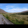

Highland


Rannoch Moor. Rannoch Moor. Rannoch Moor. Looking towards Glen Coe from just after today's summit, which is about 20 metres higher than ... The peak is Stob Dearg, 1022 metres tall. It separates Glen Etive on the left from Glen Coe on the r... Glen Coe. Glen Coe. The River Coe. Glen Coe. Tourists. Two of the Three Sisters. Another view of Glen Coe. This mountain is Sgorr nam Fiannaidh, at one end of the Anoach Eagach ridge. I did once scramble dow... Another view from the same place. The Clachaig, a pub well-known by hillwalkers. Scenery. For a few kilometres I'm using this road as an alternative to the busy A82. I expected this road to ... My view while I was having a long rest in the sunshine on the edge of the village of Glencoe. The vi... A view from the bridge at Ballachulish. Loch Linnhe, a sea loch. Looking the other way, back towards Glencoe. In the middle of the picture, between us and the tree, are two walkers with backpacks, who are also ... This building in Onich used to be the Post Office. It has one phone box in its garden and another ou... From Glencoe to here, the footpath has been signed as also being a cycle path. I wondered why the qu... You might be able to make out the Corran ferry crossing the Loch. For the last couple of kilometres, the road had a footpath so I rode on that even though there were ... Loch Linnhe, looking towards Fort William. I won't be going any further today though. Instead I'll be spending the night here. Another view of Loch Linnhe. I'm writing this caption in the room at 19:42 and there's no evidence of any extraction happening. Booking a table in the restaurant was probably a mistake. On the way out, I got a glimpse of some of... While eating, I get a view of this Austrian coach driver and his two cold drinks. Loch Linnhe. Loch Linnhe. Fort William. Fort William. Another bike shop. I still don't need one. The pipes on the mountainside on the right of the picture... A footbridge over the Fort William to Mallaig railway, which is the line which the steam train calle... Here are some of the Jacobite's purple coaches. People working on a railway bridge. The same bridge. After being hidden by clouds until now, Ben Nevis has just revealed itself. For today and tomorrow, I will be riding along the Great Glen, a geological fault line which stretch... This flight of locks is called Neptune's Staircase. From the top, it looks like the canal just disappears. The Caledonian Canal at the top of Neptune's Staircase. A canoeist. The boat traffic is different to most canals. The Caledonian Canal. The Caledonian Canal on the left and the River Lochy on the right. Here's a swing bridge over the Caledonian Canal but the thing that I'm most interested in is the lit... The upper lock at Gairlochy is the only lock on this canal which wasn't part of the original design.... Loch Lochy. Part of Loch Lochy. Loch Lochy. A mushroom. The start of my route through Clunes Forest, along the West side of Loch Lochy. It's also the Great ... The Great Glen Way. One of many small waterfalls. I think I'll take this descent cautiously. In the woods. A section of the Great Glen Way, and the cycle route, has been diverted further up the hillside for ... I'm impressed at how much effort has been put into building this temporary path. Periodically it has... The temporary path eventually connected to this existing forest track. Its surface is a mixture of s... Looking towards the North end of Loch Lochy at Laggan. The start of the next section of canal. The station at Invergarry. There are noticeboards showing the plans for renovating the station but t... I'm not sure where the railway line went. My path diverged from it shortly after Invergarry station ... ... and this is the view in the other. I wonder whether that buttress was there when trains were running. This was the only part of Loch Oich that I got to see. The Bridge of Oich, which carried the main road until 1932. I'm going this way. Looking down the flight of locks at Fort Augustus towards Loch Ness. After living on this island for... In Fort Augustus. My accommodation for tonight. Three of my last six rooms had the problem that there were no power sockets near the bed so in order... There is a fancy shower which has an option to have the water spraying out like this but that wasn't... This is where all the chairs are. An unusual AA sign. This is St. Benedict's Abbey, which was a monastery until 1998 and included a boys' school until 199... I've come to what was the school's boathouse because it is now a restaurant whose menu looks good. In the restaurant. A view of a boat passing from Loch Ness into the canal. Loch Ness. If I hadn't come to this restaurant, that jetty over there would have been the best place to get a l... The building on the left is the abbey's very impressive clock tower. The one on the right is a littl... Me at Loch Ness. The gates of the abbey. The purple sign explains that if you know the code you should type it in, an... A view of Loch Ness in the sunshine. The gates around Fort Augustus definitely have some security issues. Today I have to get from one end of Loch Ness to the other. I had thought that I might do that using... A little tree which has taken root in a crack in a rock. Fort Augustus. A slightly different view. Loch Ness. Scenery. Loch Tarff. Scenery along the military road. These roads were built in the mid 18th Century to link forts across the Highlands to enable the Brit... Scenery. I'm now at the summit of the road, at a height of 392 metres. That's about 70 metres higher than ... I'm not the only person admiring this view. Normally I find it difficult to get a good photograph of horses grazing because as soon as they see ... A different type of mushroom. Garden chairs in a bus shelter. The little signs kind of imply that anybody is welcome to sit in these chairs but I didn't try it. I... I've encountered an organised group of cyclists who are also heading for Inverness. I think they hav... The light-coloured edifice on the far bank is Urquhart Castle. The gate of this establishment had rather a rude sign saying something like "No public toilets.... The Northern end of Loch Ness. A field speckled with sheep. A rare bit of Highland arable land. Inverness. The River Ness in Inverness. There are several people in various uniforms standing around outside the Armed Forces careers office... Inverness Town House. The three tilted piles of jagged slabs are apparently called the Three Virtues. Inverness. I considered staying in the hotel above Hootananny tonight. It's another of those hotels where the r... Inverness. Looking down an alleyway towards a pedestrian bridge over the River Ness. I'm actually staying here: a hotel called the King's Highway. It's cheaper than Hootananny and proba... A transparent plug. That's unusual. My route home may or may not involve ... Inverness. A sundial. Like the one in ... It's also got its coordinates written in a way which doesn't look at all natural. I did look up vari... The sundial is on the monument. That's the bridge which I will be using tomorrow to cross the narrows which separate the Beauly Firt... For the last couple of weeks, there has been an occasional clicking sound which feels like it's comi... I'm surprised at how few depictions of this creature I've seen in the last couple of days. In fact, ... If that coach wasn't parked there, you would be able to read the full text: "THE ROSE STREET FO... After three attempts, I've managed to buy tickets to get the bike and me home next weekend. A ship next to a pile of logs in Inverness docks. I have seen quite a few lot of lorries loaded with... Over the course of this trip, the numbers of the roads and the cycleways have been gradually increas... Another view of the Kessock Bridge. The Caledonian Stadium, home of Inverness Caledonian Thistle. The diversion goes round in almost a complete circle past the stadium and ends near here on the oppo... Looking out into the Moray Firth. The Kessock Bridge. A last look at Inverness. The murals in this underpass are good. I'm surprised there isn't a longer queue of traffic behind that. These horses didn't come over to see me either, and they haven't even got their eyes covered. Dingwall. Dingwall. There's a lot of yarnbombing in Dingwall. Most of these bollards have some sort of hat. Father Christmas. Still in Dingwall. The things hanging around the post box are various school supplies. I think this one's a book. There's a monster! Suites? Apparently there are still 61 Wimpy restaurants in Britain but it's been years since I've seen one. The Cromarty Firth. The low bridge across the firth is the A9. I drove across it both ways about a year ago. Today my ro... After Evanton, there is a fun cycle path which stays close to the road but weaves its way between tr... A private level crossing. Some of the signs around here are very rusty. Alness, where I will be staying tonight. The building in the middle of the picture, with the round tower on its corner, is my hotel. It turns out that I'm actually staying in an annexe across the road. This is my view. I parked my bike outside an ice cream shop which must be good because I've seen a lot of people eati... This is a pretty good restaurant. The waiter-come-bartender is extremely chatty. He's from Kent. I t... Given that the A9 bypasses Alness, I was surprised at how many emergency vehicles were hurtling alon... The mist has evaporated now and it's a hot sunny bank holiday. There is a dockyard hear here which builds and repairs oil rigs. Here you can see some of the rigs b... Two inactive and unattended combine harvesters. It seems unusual to see them just left out in a fiel... The second of two small pelatons of cyclists promoting a charity called Heather's Heroes. The four v... Just a pretty garden. Reminding me that I'm in Scotland. Tain. This is what appears to be the entire staff of the Glenmorangie distillery lined up outside the entr... Dornoch Firth. This section of the A9 has shoulder strips so I can ride without impeding other traffic but this slo... There's a lovely smooth surface on this minor road towards Dornoch. This looks like a deliberate wild flower meadow. If I'm not mistaken, those look like classic examples of 20th and 19th Century school buildings. Dornoch is obviously a tourist town. There are lots of places advertising food. Apparently you can g... Dornoch. Both signs say that the cathedral tower only opens on Saturdays and that it's open now. Dornoch. Dornoch. The coast of Sutherland stretches off into the distance on the right. I will be riding along that fo... This was going to be a picture of a group of geese standing on the rocks but it turns out that geese... I will now have to do about 10 miles today and another 5 miles tomorrow morning on the A9. I could m... Just a dam. Having come this far, I've pretty much decided where I'm aiming for now. Golspie. I recognise it. Last year on my drive from Inverness to the Orkney ferry, I stopped here to... A little wooden beauty salon. Another interesting building. You don't often see distances that big on a milestone. Dunrobin Castle has its own railway station. The entrance to Dunrobin Castle, home of the Earl of Sutherland. An iron age broch. Brora, looking beautiful in the sunshine. The ice cream shop here looks quite appealing. I was about to start looking for the pub where I will be staying tonight, but then realised that I'm... I didn't use the bike rack outside the pub because it turned out that it wasn't actually secured to ... It's another nice big room but with more beds than I really need. I like this view. My bike is in a musty function room behind the black door under the fire escape. The only person who... The two people silhouetted in front of the shimmering sea are playing golf. Looking back towards Brora Beach... ... and forwards towards Crakaig Beach. Sheep dozing on a ridge. There was a bit of rain during the night but the weather today is much sunn... There are some cows watching me from beyond the cattle grid. I thought they might make it difficult ... A view. I had a choice of two ways to get to Kildonan: a flat route staying close to the railway line or a r... The scenery is beautiful. A mountain spring. This road is extremely quiet. I was on it for two hours and only saw two vehicles in that whole time... An abandoned house. Another broch. Glen Loth. A wonderful view from the summit of the Glen Loth road down into Strath Ullie, also known as the Str... That's where I will be going next. The scenery on this road is wonderful. I'm glad I came this way. A rare appearance of a "C" road number on a sign. Strath Ullie. Kildonan station. The river is called the Helmsdale, which is strange because it sounds like that should be the name o... On one side of the road there's this makeshift climbing frame... ... and on the other side there may or may not be eggs. Strath Ullie. This is another day when I'm staying close to a railway line where the trains stop every 10 km or so... Although noticeably busier than that road over the hill this morning, I would guess that this road s... Loch an Ruathair. That hill has been thoroughly logged. Looking back Southwards the sky looks quite threatening but it's been sunny all day for me so far an... I don't know what Mackay Country is but I think it might be the same as the historic county of Caith... Having crossed that ridge, I'm now in an area called Flow Country. It's the biggest blanket bog in E... This place is so remote that I thought it was quite likely I would have no mobile phone signal tonig... Forsinard station. The line is double-track here so that northbound and southbound trains can pass e... That's where I will be staying tonight. I've been sent check-in information which says that the plac... A poster at the station advertises a tea room about a mile from here but says that it doesn't open o... Forsinard station. The plaque in the foreground, which was unveiled by the King, says that the Flow ... There's a bird on the post in the middle of the picture. I think it's a robin. I thought I should ta... The lounge. It looks like there might be some kind of breakfast here in the morning. This is what I was looking for. The check-in instructions said that because of all the peat around h... It's a pleasant little room. The windows open wide, which is unusual in hotels. Normally a breeze is... From my open window I can watch trains at the station. This is the first northbound train on this li... The check-in instructions confirmed that there is no food served here, just a little kitchen area wh... A side room. This is where the hotel's reception would once have been. The framed page of writing on the wall... ... lists all of the named geographical features in the Forsinard Flows region, with their translati... In the distance you can see two women in the road. One is pulling a suitcase on wheels. When I passe... A highland cow. Strath Halladale. Strath Halladale. Most of those notices are protesting about plans to build pylons here. Either they're too late or th... I can see the North coast. Old machinery. Here's another of those "Mackay Country" markers. It is indeed on the border between Suthe... On the left side of this picture, beyond the sea, you can see some of the Orkney islands. The former nuclear power station and research facility at Dounreay. Just a pretty cottage. Scenery. Scenery. I've been separated from the railway line since leaving Forsinard this morning but now I can see it ... And here's where it ends. I'll be back here on Saturday morning to start my rather complicated rail ... The weather forecast predicted a headwind which would get gradually stronger throughout the day. I s... I filled both of these bottles with water from ... The bar tape is wearing a bit thin now. Thurso. The beach at Thurso, looking towards Scrabster. If I had come here half an hour ago, I could have wa... The land on the horizon in the left half of the picture is Orkney. On the right is Dunnet Head, the ... It's a shame the café's closed. I wouldn't mind an ice cream now. A fancy water fountain. A man in the sea. The mouth of the River Thurso. Thurso. I've been passed by a few of these buses while in Scotland. They're electric. The River Thurso. Just a man washing his van. They seem keen on round towers in the Highlands. My hotel. With hindsight it would have been better to book somewhere a bit further East, close to Du... The bike has a bit of shelter tonight. A strangely specific warning in my room. I expect that most guests wouldn't even have an Allen key. He painted Thurso's smokey tops? At the moment it's drizzling slightly but the cloud can't be very thick. That light spot is the Sun. Dunnet Head. Like Shetland and Orkney, Caithness has a Nordic flag. Another view of Dunnet Head. I got to the start of the road to Dunnet Head just at the time when it was officialy closed so that ... Looking inland from the road to Dunnet Head. Loch Burifa looking like an infinity pool with the sea beyond it. The bike racks here look a bit ancient but I suppose they match the colour of my bike. It's not just the most northerly point: it's also the extreme point on all bearings from 258 to 360 ... I can't actually get to the northernmost point because it's private land. North is the direction in ... Some tourists or, perhaps more accurately, some other tourists. Hello. 27 days ago I was at Britain's southernmost extremity, ... Those cliffs are home to quite a lot of seabirds. You won't see them with this camera though. Heading anticlockwise, the next point on the convex hull is Cape Wrath, 94 km away. If you look care... To Cape Wrath. Dunnet Head Lighthouse. Cliffs and a boat. Looking Eastwards. The island on the left is Stroma, the nearest of the Orkney Islands to mainland B... Zooming in a bit, we can see the next two headlands which touch the convex hull: St. John's Point an... To St. John's Point. Another picture of me at Dunnet Head. This explains what the visible bits of land are. In real life I can see the stack known as the Old M... Part of a Second World War radar facility. The left one of these two boats is the ferry which I saw in the distance yesterday. This time it's h... A low-flying plane. At one time when contemplating this route, I considered staying there. On the left is Mey Castle. A similar view. St. John's Head, my next destination, is in the middle of this picture. At this point in the trip, I'm carrying a lot of stuff which I could tolerate having stolen so I've ... The path to St. John's Point. Rocks off St. John's Point. Part of St. John's Point. An inlet. St. John's Point is the extreme point on bearings from 7 to 9 degrees. Although St. John's point only deflects that theoretical rubber band by 2 degrees, I think it's actu... At low tide the land does actually extend a bit further North from here, and that stack becomes join... To Dunnet Head. Looking towards Duncansby Head. To Duncansby Head. Stroma. There's the Pentland Ferry, the one which I used when I want to Orkney last year. Looking towards John O'Groats and Duncansby Head. Entering John O'Groats. My hotel is the white building straight ahead but it's too early to check in... The northern end of the A99, leading into the car park at the John O'Groats visitor centre. John O'Groats. John O'Groats. John O'Groats. I think there is still a ferry from here to Orkney for foot passengers only. I said I would be at the hotel some time within the next hour so I've got time for some ice cream an... I've left my panniers in the hotel now so I'm riding with the backpack. My helmet snagged on it thou... This is the last picture I've got of the bike on this trip. It's done well. It's had three broken sp... The Ness of Duncansby. The bench has disappeared and one of the fishing baskets is being used as a bin. A straight line from St. John's Point to Duncansby Head passes along these rocks so at low tide, whe... The ground is made of fragments of shells. Looking inland from the rocks of the Ness of Duncansby towards the high water mark. Looking West. Zooming in, we can see... ... St John's Point with the higher ground of Dunnet Head looming behind it. There isn't a picture o... Looking East to Duncansby Head. There's Duncansby Head. Washed-up seaweed. The Ness of Duncansby. I don't know what they're looking at. The eastern end of the rocky strip of the Ness of Duncansby, pointing towards Duncansby Head. We didn't really need another picture of it. Me on the Ness of Duncansby. Now my route goes through here... ... and up there. A hole in the ground giving a view of the sea. Duncansby Head. From here you can see the next three places on the convex hull heading westwards: the Ness of Duncan... Three of them. Looking towards Duncansby Head. This straight section of fence points towards the Ness of Duncansby and St. John's Point. The coastl... Next up: Duncansby Head. Now I've moved on to Duncansby Head and am looking back to where I took the previous picture from, a... I'm slightly alarmed to see that that's what I was just standing on. Duncansby Head lighthouse. I think the island in the distance in this picture is South Ronaldsay, the island which the Pentland... Duncansby Head lighthouse. Looking West. The Stacks of Duncansby. Nothing in this picture is on the convex hull but the stacks are quite spec... The short section of coast which is inaccessible behind the lighthouse includes the limits on all be... There it is though. Where I'm standing is the extreme point on 58 degrees. From here, the theoretical rubber band heads ... Towards Rattray Head. That's all for this year. I hope you enjoyed some of it. Goodbye.