Back to the 2025 index page
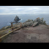
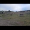
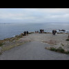
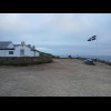
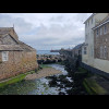
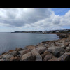
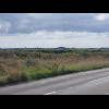
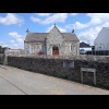
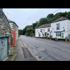

Cornwall


Hello. This year's trip is going to be a bit chaotic. I don't really know where I will be going but ... On the far horizon, you might just about be able to see the Lizard peninsular, which is the next of ... Just about where I'm pointing is where the Lizard peninslar ends, but it's hard to see in this pictu... The view from Gwennap Head anticlockwise to the Lizard. Gwennap Head. Gwennap Head. I'm now starting the walk to Land's End along the South West Coast Path. Here is a Coastwatch Lookou... Distances and bearings to some other landmarks. I've now reached Carn Guthensbras, the most South-Westerly point of Great Britain. In fact it's the ... Looing from Carn Guthensbras to the rubber band's next contact point, which is Pordenack Point, abou... Hello. The view out to sea from Carn Guthensbras, including... ... the Scillonian III, the ferry between Penzance and the Isles of Scilly. I watched it heading out... Carn Guthensbras. The view from Carn Guthensbras anticlockwise towards Gwennap Head. The view from Carn Guthensbras clockwise towards Pordenack Point. That's Pordenack Point. The South West Coast Path. A little stony bay. The South West Coast Path. There are some big caves in the cliffs. I can see some more ships. A remote house. Another bay. Carn Boel, a dramatic headland which I didnt actually have to come onto. Pordennack Point. Pordennack Point. It's the extreme point on bearings from 230 to 234 degrees. It also, apparently, has a bronze ae barrow cemetery. Pordennack Point. Longships Lighthouse. I hope the people who I was discussing this rubber band think with don't mind but Im not actually go... Thats Carn Guthensbras, where I was an hour and a half ago... ... and that's Carn Green, where I will be soon. The view from Pordenack Point anticlockwise towards Carn Guthensbras. Pordenack Point. By the way, I won't be taking this many pictures every day. I just want to make sur... The view from Pordenack Point anticlockwise towards Carn Guthensbras. Islands. Looking back towards Pordenack Point. That man is still up there. Heres the next contact point: Carn Green. Carn Green, the extreme point on bearings from 234 to 250 degrees. Carn Green. The view from Carn Green anticlockwise to Pordenack Point... ... and clockwise to Land's End. Donkeys. Greeb farm is part of the Land's End tourist attraction. The visitor centre has closed by now but the cliffs are still accessible. Ignore this. This is me pointing at Pordenack Point, which is not the next contact point. I must hav... Pordenack Point and Greeb farm, seen from Land's End. Land's End, the extreme point on bearings from 250 to 260 degrees. Land's End. I dont know what I'm trying to show here. Pointing to the next contact point, Dr. Syntax's Head. The view from Land's End clockwise to Dr. Syntax's Head. Tourists. Tourists. This is the big one. From Dr. Syntax's Head, the rubber band stretches 740 km to Corrachadh Mò... The view from Dr. Syntax's Head anticlockwise to Land's End. The view from Dr. Syntax's Head clockwise towards Corrachadh Mòr. Dr. Syntax's Head is the extreme point on all bearings from 260 to 268 degrees. Some cyclists have just arrived from John O'Groats. This isn't really going to be a walking holiday though. Here's my bike where I parked it earlier. Tonight I will be staying here. Its a pretty nice room but I'm a bit concerned about how close the bed is to the walls on both sides... The good news is that getting out of bed here wasn't any more dificult than it has been anywhere els... This place calls itself a hostel but that description didn't really fit my room. This area is a bit ... This is St. Buryan. Yesterday I bought some snacks from this shop and then sat over by the church en... A little snail on the table where I'm sitting. What looks like it used to be a toilet is now a book swap place, and the toilet has apparently moved... The Merry Maidens Stone Circle. A road and some of the orange flowers which are quite prevalent around here. The village of Paul and a view of Mount's Bay. St. Michael's Mount is the light-coloured structure w... Descending into Newlyn. Newlyn. The shop on the left claims to be the oldest Cornish pasty maker in the world. Looking along Newlyn harbour wall. The small red and white hut at the base of the lighthouse contain... A group of chidren on the stony beach at Newlyn. Apparently that is a sauna. Newlyn. Newlyn and Penzance merge into each other. In the forground here is a relief map of the area. The wh... Parked in Penzance. The building on the right of this picture is Penzance railway station, the end of the line. The buil... People have suggested that having a hot bath might help my back so every night on this trip I've bee... Penzance station on a Friday morning, where I'm setting off to try to ride to the Lizard, just like ... Penzance. Here the South West Coast Path is also open to cyclists and runs between the railway line and the co... Two railway carriages and a little shunting engine. St. Michael's Mount. This side of that building says that it is a massage place. The other side says that it is a kite su... St. Michael's Mount and part of a sculpture called Gwelen. St. Michael's Mount is a tidal island. When I was here on Monday, there were constant streams of tou... The lay-by the middle of this picture is where my bike broke down on Sunday. Luckily it's a bus stop... St. Michael's Mount with the Land's End peninsular behind it. They are getting ready for a vilage fair in Goldsithney. This flag looks like it depicts an old road... Godolphin Cross. Bees on some lavender in Helston. Some Cornish towns have signs which point the way out. Thats helpful. The only other place where I'v... An old finger post on the road to Lizard. Some signs call this place Lizard. Others call it The Lizard. It's the southernmost village in Great... Tonight I am staying at the Top House Inn. I assume it gets its name because, through a combination ... The building with the three chimneys to the right of centre in this picture is where I stayed on Sun... On the far horizon is Gwennap Head. Two days ago I started this blog over there looking at here. Oh look! I've got a bath. I wasn't even expecting that. I need to go for a walk along the coast now.... This is where I stayed on Sunday. Of course, the thing in the garden was a helicopter. On Sunday the... I'm back on the coastal path to investigate the places around here where that hypothetical rubber ba... The situation here is a bit complicated to explain because it chages with the tide. There are some r... The view from here clockwise to Gwennap Head, which is on the horizon above where the seagull is. Looking inland. It's me. Pointing to Gwennap Head. Pointing to where the southern tip of Lizard Point is at high tide, which isn't where I should be po... The view from here anticlockwise to the next two high-tide contact points. A last look at this place. Now I've moved to the next place which is a contact point. I'm pointing at where I just was. The same view but without my finger. Now for some reason I'm pointing at the southern tip of the tidal rocks. The rubber band doesn't go ... Lizard point. At high tide, this is the extreme point on bearings from 186 to 193 degrees. Lizard point. At high tide, the bend on the road where the people are standing is the southernmost t... A view including the old lifeboat station. The old lifeboat station and the beach at Lizard Point. This is as far as we can go. The view from the Lizard Point tidal rocks clockwise to Gwennap Head. The view from the Lizard Point tidal rocks anticlockwise towards Beachy Head. At low tide, this is the extreme point on all bearings from 165 to 194 degrees. Pointing towards Gwennap Head although I cant see it now. The cliffs here and there are each about 5... And of course we can't see Beachy Head because it is 397 km away. Looking across the tidal rocks to where the shore is at high tide. Lizard Point, seen from the permanent land. At high tide, this is the extreme point on bearings from 179 to 183 degrees. Looking clockwise. That's the second of those unnaned places where I was earlier. It's the next place round from here c... There's the next place anticlockwise at high tide. I will go there next. Lizard point. I'm not actually going to the promontory in the picture but it's quite interesting. The square white... I assume the Chasm of the Lion's Den must be a geological feature here, otherwise that last sentence... This is the last place on the coast that I want to visit: the extreme point on bearings from 165 to ... Here I am. Looking clockwise to Lizard Point, and this time correctly pointing at the high-tide limit of the la... Looking anticlockwise towards Sussex. Clockwise. Anticlockwise. The lighthouse station, including some foghorns. A similar view to one from a little while ago. The lighthouse's Fresnel lens is glinting in the sunlight as it turns. I was thinking of having dinner here but its far too busy. There is a beer festival going on. The mixer tap in my room only has a red dot on it, which turns out to be accrate. If you turn it one... Getting ready to leave Lizard for the second time in a few days, this time on the bike rather than o... The road to and from Lizard isn't very pleasant. It's hilly and quite busy. On the horizon about a quarter of the way across this picture you can see one of the big satellite d... A fighter jet on display in a corner of the Navy air base RNAS Culdrose, also known as HMS Seahawk. A view of the sea. A procession of scooters on the Helston bypass. I stopped for a long rest here by Helston Rugby Club. The two dominant estate agents around here are... Google Maps directed me across this field where the circus is. Unfortunately, soon after that its ro... This is a much more pleasant road. Shame it's so hilly. A carved stone poiting the way to a monumental masonry business. I don't know what that old structure is. The old school in Wendron. It's a very small village so the new school is just across the road. Another abandoned building. Judging by the chimney, it must have been industrial. Scenery. A signpost. I sat on the stone strcture to have a rest and eat a bag of sweets. After a while, I was surprised b... Two of at least 12 Austin Sevens which I encountered on this narrow road. A viaduct. Passing under a railway line on the way up yet another hill. I don't know what that box was originally built for but now it seems to be where the people at one o... A road and railway handling the terrain differently. I will come to find on this trip that major towns and cities in the West Country somehow hide themse... Two old women in a sports car. Truro, Cornwall's administrative centre and only city. Looking one way along Boscawen Street, Truro's main street. Looking the other way. The man on the left, who is partially hidden by a pole, is preaching the gosp... Truro. Why? Even if the company is a partnership, you could still have just called it Chilcott's. This is where I'll be staying tonight. Surprisingly, it's cheaper than any of the three previous nig... There's a wedding party here. That's the best place I can find to park the bike. Here's the bride, fanning her friend. Here's the bed. Oh, and I get another bath! I wasn't expecting that. This is the second hotel I've ever been to which has given a complimentary bottle of wine. The first... The hotel is quite a warren, with funny short flights of stairs everywhere. I like that. Italian is ... Here are some of those stairs. To get to my room I have to go down the five and then straight back u... Here's the wedding party again. As I suspected, the restaurant is epensive enough that with dinner included, this is no longer the c... I'm following Google's suggestion for how to get out of Truro without having to go up a big hill on ... That's not a normal Waitrose slogan. A village called Ladock. A man and his young daughter saw me photographing this sundial and paused to have a brief look at it... The A30 ominously disappearing up into the mist on Bodmin Moor. I have to go up there too. There's a running race going on in Indian Queens, although some of the competitors have obviously gi... Google didn't seem at all keen on coming this way but it's the way that I want to go. It's the old c... I didn't epect to see this emerging out of the mist. Bodmin is quite unusual in having signs which specifically show where its cycle parks are. Bodmin. My hotel is about 80 metres above the level of the town centre so I still have to walk up another bi... It feels like I'm back out in the countryside now. If I didn't have the map, I would have no idea ho... In my hotel room. Apparently, in Cornwall even the bees are black and white. This is the A38, just a few hundred metres from its very end. It's pointing the wrong way though. Th... I don't know if the bus is where the fist and chips were actually served from or if it's just advert... I've just had a long steep descent on this road but had to keep the brakes on hard all the way. This disused railway line stays close to the River Camel so it avoids the hills which the nearby roa... Where the trail crosses the road, there are still some intact pieces of railway track. St. Breward, on the edge of Bodmin Moor, has some strange things. Another house has dolls and puppet... It rained hard for most of the time that I was on Bodmin Moor. I don't have many pictures because, a... Here, my route takes me along one of the taxiways of the old Davidstow Airfield. Those sheep are probably just sheltering from the driving rain but they look like they are waiting f... Tonight's accommodation opens at half past three, which is just about when the rain is forecast to e... Another narrow road. A village called Trewen. Here's my room for tonight. Rhododendrons on the path from my building to the reception and restaurant. The storm has well and t... The view from the restaurant window. This place is actually a golf club. Launceston, the last town in Cornwall. Launceston. Launceston. Launceston.