| Back to the previous photograph | |
|
| |
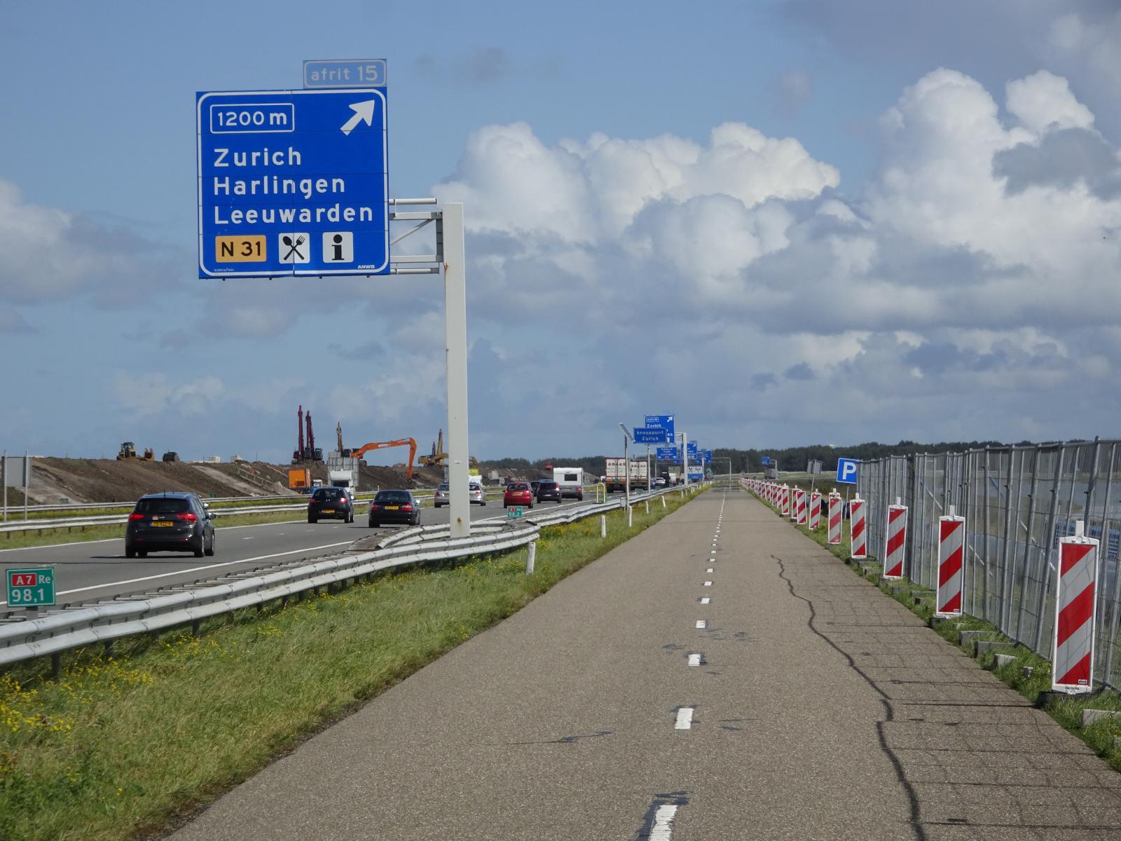 Looking back to where I've just come from. I'm now at the beginning of the Afsluitdijk, the 32 km long dam which links Friesland to North Holland. It was first proposed in 1886 and completed in 1932. A number of these long dams were built across what was then the Southern Sea, the Zuiderzee. The areas enclosed by some of them were drained to form the new province of Flevoland. The other dams turned the Zuiderzee into two non-tidal freshwater lakes, the IJsselmeer and the Markermeer, reducing the risk of flooding. I mentioned this in 2011, when I road across the Houtribdijk. This year, I'm on the Asfluitdijk, the outermost dam which now separates fresh water from salt water. The proper cycle lane should run along the top of the embankment on the left of this picture but, as you can see, there is construction work happening there. I'm currently on the service road which goes to an artificial island about 4 km into the dam's 32 km length. At the island, I should be able to transfer back to the proper cycle lane. UTC Time: 10:53, Saturday 07 September 2019 Local Time: 12:53, Saturday 07 September 2019 Estimate of longitude: 5° 21' 5.62" E = 5.351560° Estimate of latitude: 53° 4' 40.87" N = 53.078020° Possible error on position estimate: 10 metres | |