| Back to the previous photograph | |
|
| |
 Somebody looking at my pictures pointed out that the last three hotels have all had green walls behind the bed. Now it's four in a row. Now we come to the part of the trip where I have to deal with three major rivers: The Missouri, the Mississippi and the Ohio. The map below shows all of the bridges within the path of totality where it is legal to ride a bike. The Missouri River does not actually cut all the way across the path of totality but it comes so close that it is not possible to stay within the path of totality on public roads on this side of the river. That doesn't matter though because there are loads of bridges across it and they all look bike-friendly. I will probably end up crossing it four times. The other two rivers are trickier. The shortest route would be to use the Chester and Brookport bridges but I don't much like the look of either of them. The Chester bridge is on the Transamerica cycle route, a recommended route for trans-continental cyclists, but it's long and narrow and doesn't look much fun. The Brookport bridge looks even worse. The section over water is about 1200 metres long and made of a metal mesh but if you include the ramps at either end then it's at least twice that with no room to overtake. For safety, I am inclined to go for the meandering route over the Bill Emerson Memorial Bridge and the Shawneetown Bridge. 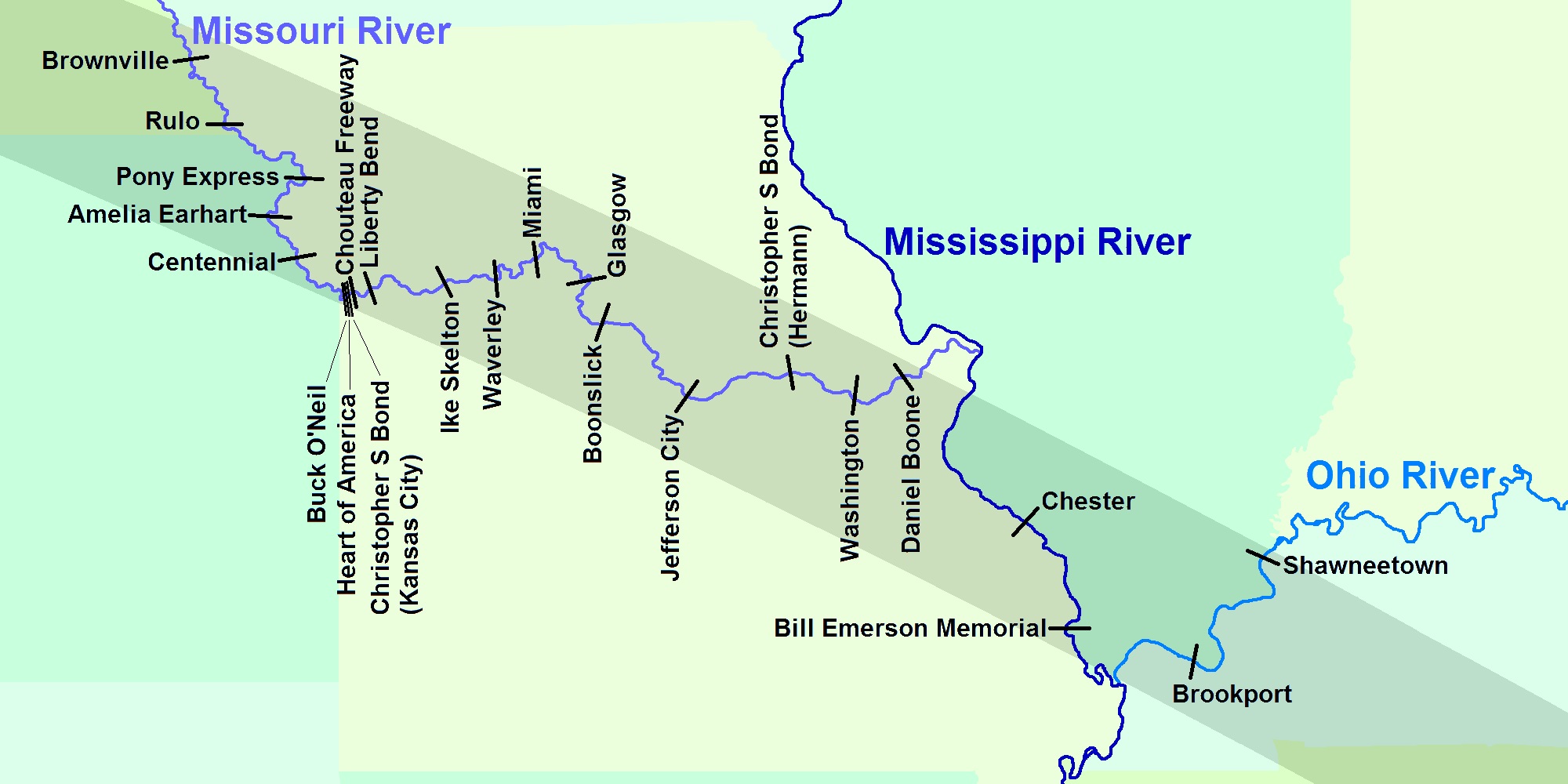 UTC Time: 22:08, Tuesday 22 August 2017 Local Time: 17:08, Tuesday 22 August 2017 Estimate of longitude: 95° 31' 33.20" W = -95.525890° Estimate of latitude: 39° 50' 32.96" N = 39.842490° Possible error on position estimate: 100 metres | |