Back to the 2015 index page
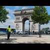
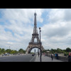
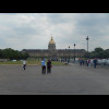
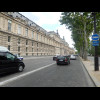

London to Paris


Three o'clock UTC, four o'clock here in London. This is when I start to try to answer a question whi... The centre of London is less well-defined than the centre of Paris but the place with the best claim... Although Charing Cross is often considered to be the centre of metropolitan London, it isn't within ... The end point in Paris is in front of the Cathedral of Notre Dame so an alternative sensible start p... Touching St. Paul's Cathedral after 13 minutes. The Tower of London, with the Shard building behind it. Tower Bridge. I have heard some people consider that a London to Paris trip could be from Tower Bridge to the Eiff... A park. The scenery while  I was waiting at traffic lights on the South Circular Road. My route across Streatham Common. Unfortunately I didn't get to enjoy this downhill because a tyre had come off a car at the bottom an... Here I'm leaving Greater London and entering Surrey. I thought the bus stop in the foreground would ... The very edge of London's urban sprawl, seen from outside. Behind me is a roundabout and then green ... A field. Woldingham School has this private road which I believe is less hilly than the public one and bikes ... Part of the school. The other part is much more modern and ugly. I'm not sure how much of this land is owned by the school. The playing field in the foreground is. The last London feature I will see: the M25 orbital motorway. This road has remarkably wide shoulders. It looks on the map like it used to be a railway line but i... This part definitely was a railway. Lewes, in the fading light. The castle is on the left, in front of a chalk cliff. Newhaven looking sleepy. I've made it to the ferry check-in on time! I always think it looks a bit funny when a country has a door. In the queue to board. This cabin is quoted as having four bunks but I reckon you could get another two people on this wind... My cabin is in a great location: right over the bow of the ship. That would mean though that it woul... This was the distance for the London to Newhaven leg of the journey. 100.26 km or 62.30 miles. The bike locked up on the car deck. The ferry. Diepe. Nights don't last long at this time of year. For the next few hours, the Avenue Verte, a nominal London to Paris cycling route, will be well-sign... French village scenery. The red telephone box is something to do with attempts to twin this village with somewhere in the UK... Scenery. Funny trees. The off-road section of the Avenue Verte starts here. It doesn't say what that is. For the next 44 km, I will be on a disused railway line. In the middle of the picture is a short sec... Scenery. The old railway. This clock was striking seven as I rode past. I think this was a watermill. There's water gushing through it at the bottom right. On the left is a feature of the old railway. The station at Neufchatel-en-Bray. The big yellow Sun on the right is the start of a scale model of ... Just as the M25 was the last feature I saw of London, the first feature of Paris is this motorway, t... It was from this marker, several years ago, that I first learned of Pluto's demotion from planet sta... Still on the old railway. 123 km from Paris. The edge of the Solar System. More railway relics. The end of the off-road section, where this branch line meets the existing railway. Forges-les-Eaux. Forges-les-Eaux. The traffic is starting to get busier now. My road. Gournay-en-Bray. A department boundary. Bikes aren't allowed on that bridge. I've seen a lot of cats this morning. Several were just sitting on the cycle path in various places. A pretty little side street. The church is Gisors. Gisors. I suppose the Ile-de-France is France's equivalent of the Home Counties. It's the cluster of departm... Flat scenery. That row of trees is on a major road. Unfortunately, I didn't intend to come here. I've just realise... I'm back on track now and well into the urban sprawl around Paris. This was my attempt at taking a picture of an aeroplane to show that I was getting close to the Pari... I avoided the busy road and chose this nearly parallel one instead. It's rather pleasant, although i... By chance, I've happened across another sign for the Avenue Verte. I'm not going to follow it though... A roundabout. My first glimpse of the Tower. In fact, this would be my only glimpse of it until a couple of minute... Suburbs. This sports ground is built on top of the peripherique motorway, which was itself built in the space... If I'm in an arrondisement, I must be in Paris. This road unusually has its cycle lane in the middle. Cycle lane. The Arc de Triomphe. For some reason, I've never quite felt hot enough today to bother taking the jacket off.<br><br>I vi... There's the bike. Now for the Eiffel Tower. The Eiffel Tower. That's Tower Bridge to the Eiffel Tower done in 22 hours and 54 minutes. For simplicity, the watch i... One more view of this. Les Invalides. The Place de la Concorde, seen in passing. Other tourists. Just at the moment, this road is quite clear. The Louvre. City Hall. Although I thought the cenre of Paris was quite well-defined, Google Maps puts its "... Touching City Hall after 23 hours and 48 minutes. Between the trees on the left are the towers of Notre Dame. I reckon I can walk to there in 11 minut... This is the fourth time I've crossed the Seine today. It's surprisingly green. Now my journey has turned into a kind of treaure hunt. Somewhere amid all those people is the stone ... Oh no! a tour guide has just beaten me to it and is showing it to his tour party. I hope they don't ... Five minutes left. Done it, with four minutes to go. The distance for the French part of the trip: 181.09 km or 112.52 miles, making a total of 281.35 km...