| Back to the previous photograph | |
|
| |
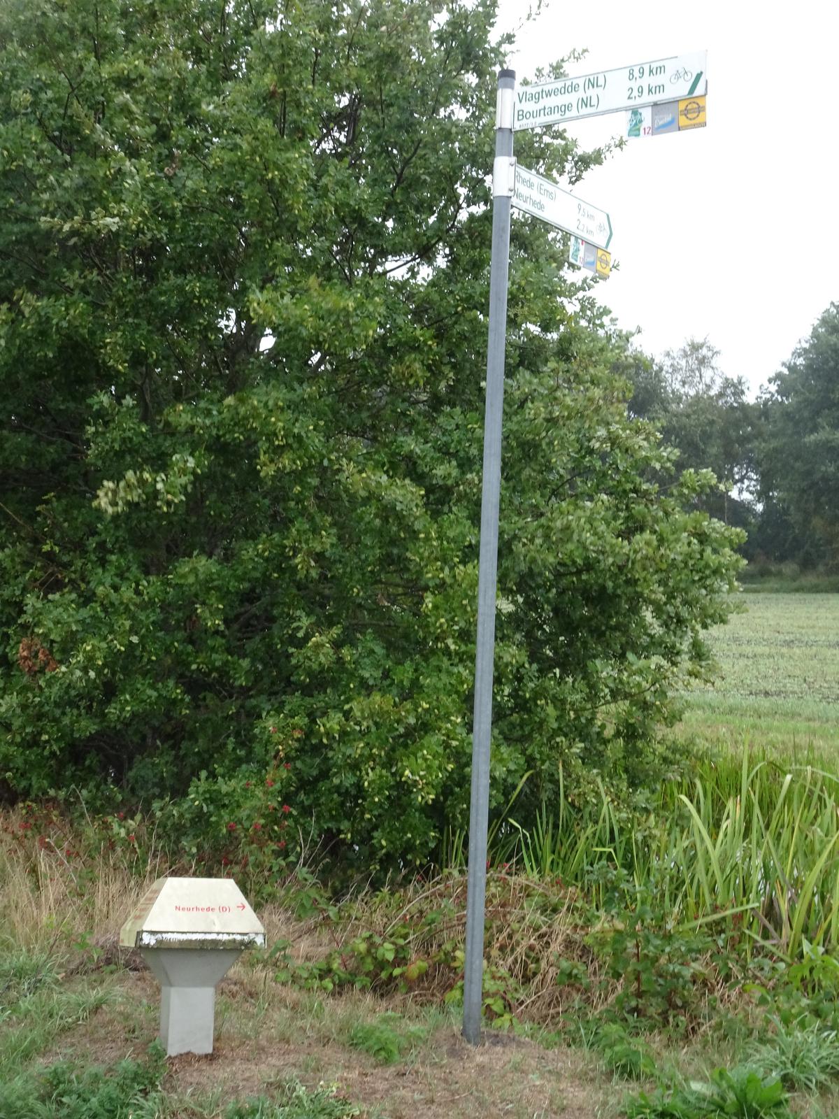 The tall green sign gives distances to "Rhede (Ems)", "Neurhede", "Vlagtwedde (NL)" and "Bourtange (NL)". It's a German sign so it specifies that the last two are in the Netherlands. The low thing with red writing is a Dutch sign, which says "Neurhede (D)". UTC Time: 13:25, Wednesday 04 September 2019 Local Time: 15:25, Wednesday 04 September 2019 Estimate of longitude: 7° 12' 30.49" E = 7.208470° Estimate of latitude: 53° 1' 40.04" N = 53.027790° Possible error on position estimate: 10 metres | |